I've always wanted to see a full galaxy map showing the locations of the various humaoid species such as the Klingon homeworld, Romulus, Cardasia, and Ferenginar. Other information like where the Federation first encountered the Borg, the location of Omicron Theta, and the various territorial boundaries (Federation space, the neutral zone, etc) would be an added plus. I've seen all kinds of conceptual Star Trek stuff, especially this one poster that shows pretty much every ship and space station in Star Trek so that you can see how they all relate to one another in scale. It seems that there would be a canon galactic map that pinpoints the locations of as many Star Trek trivia points as possible. Does such a thing exist?
Asked
Active
Viewed 8.3k times
11
-
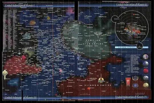
2I am not sure on the source of this map, so it's accuracy is in question, but this looks to cover most of what you've asked for. – Xantec Apr 15 '14 at 22:29
-
there's a few issues with that map - for one, weren't the badlands located nearer the demilitarized zone between the Federation and Cardassia? And what's all that extra bit of Federation beyond the Romulan and Klingon Empires? – HorusKol Apr 15 '14 at 23:03
-
You'd think so, since the Maquis, who live in the DMZ, use it to evade the Cardassians. Like I said, the source is unknown so it's accuracy is suspect. – Xantec Apr 15 '14 at 23:18
-
@Xantec Seems likely to be fanart, given that domain.. – Izkata Apr 15 '14 at 23:22
-
Cardassia also seems waaay too close to DS9, given tons of episodes in that series – Izkata Apr 15 '14 at 23:23
-
@Izkata Actually in broad strokes it is fairly close to the map in Star Trek Online, which granted isn't strictly canon but I would imagine is fairly close. – Xantec Apr 15 '14 at 23:25
-
Related: Can anyone explain the Star Trek astrography (i.e. quadrants)? – Reinstate Monica - Goodbye SE Aug 01 '14 at 19:35
3 Answers
11
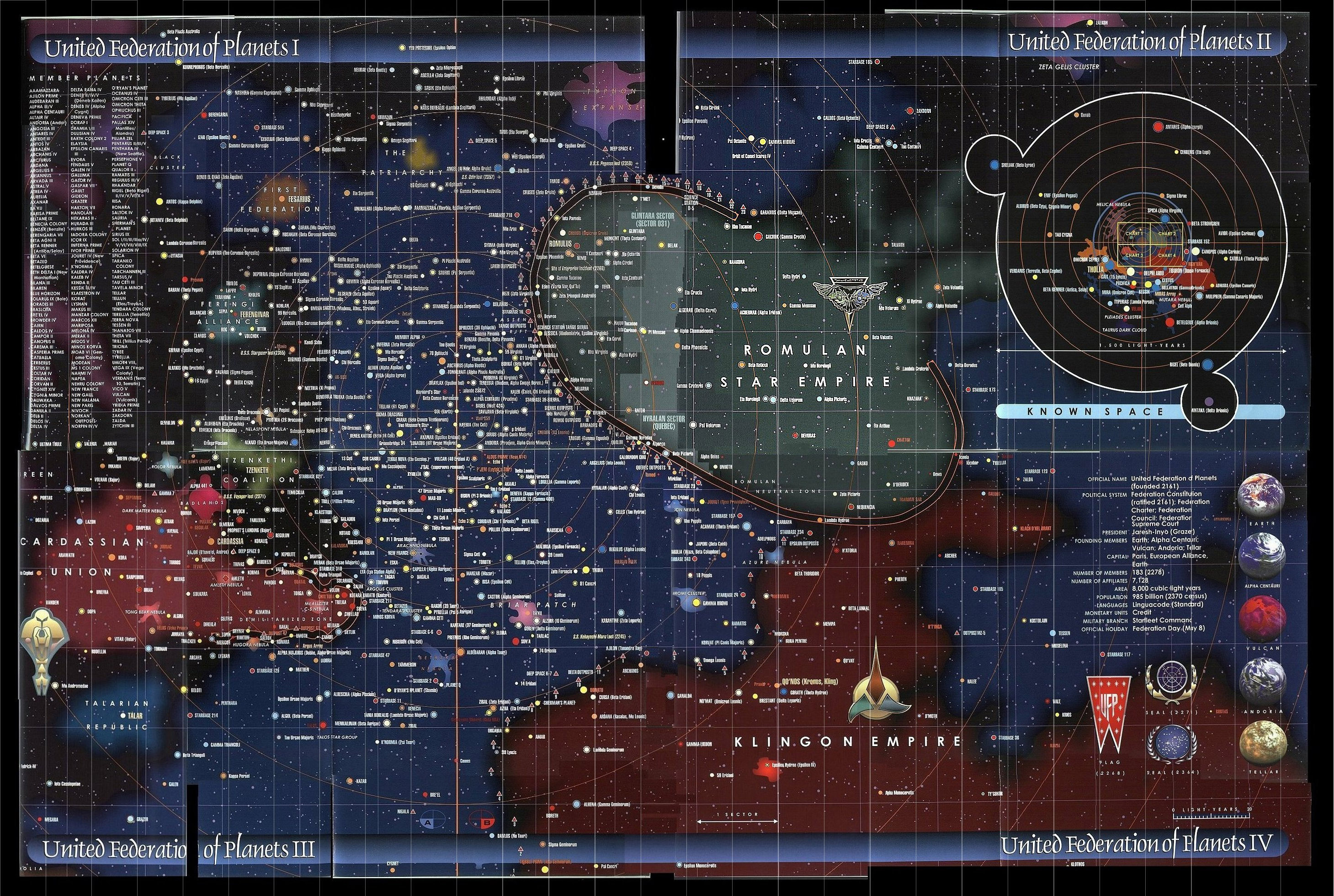
This map is one that was considered at least semi-canonical.
From "Star Charts" © Geoffrey Mandel.
(The full-size image can be found here)
Star Trek: Star Charts is a guide to the Star Trek universe – the stars and planets of the United Federation of Planets and the other powers of the Milky Way Galaxy. It includes background information on the classification systems used for identifying stars and planets.
Thaddeus Howze
- 212,750
- 23
- 708
- 994
-
-
@T-1000 sorry about the previous link. http://www.chartgeek.com/wp-content/uploads/2012/09/star-trek-map1.jpeg – calccrypto Aug 02 '14 at 03:06
3
I don't think either would qualify as canon, but there have been two published books of maps of the Star Trek universe that might at least be seen as semi-official: Star Trek Stellar Cartography, and the earlier Star Trek Star Charts (which is out of print and pricey to get used, though somewhat cheaper used copies can be found on the amazon.co.uk page). The Memory Alpha site has an article about Star Trek Star Charts here which mentions that people who worked on the show like Michael Okuda and Rick Sternbach were consulted:
Star Trek: Star Charts was written and illustrated by Geoffrey Mandel, with the help of Doug Drexler, Tim Earls, Larry Nemecek, and Christian Rühl (see below). André Bormanis, Michael Okuda, Rick Sternbach, and Timo Saloniemi gave technical advice.
There was also an older book called Star Trek Maps from 1980, but that obviously wouldn't include anything from later series like TNG.
Hypnosifl
- 56,783
- 5
- 191
- 244
2
I created such a map you are asking. I did it in 2008, so it may not be 100% accurate, as you can see in the discussions.
You can find it here:
Including a link to the raw picture itself. Please leave a comment at the video.
Snowwie
- 165
- 5
-
This is the map linked in the video: http://magical.tweakdsl.nl/GoT/galaxymap_updated.png – filmor May 04 '18 at 09:33